
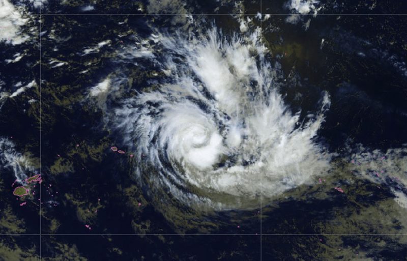
For two days on the radar, Storm Wati is set to move in the next 24 hours from a moderate tropical depression to a strong tropical depression, the last stage before cyclone status. Its forecast trajectory should lead it to approach the western part of the Austral Islands, namely Rimatara and Rurutu, therefore starting Sunday evening, confirms the High Commission, but it could lose strength by then. In the face of the strong winds and heavy rainfall expected, “state services on active watch” and the populations are urged to “remain vigilant” and prepared.
Wati “is under close monitoring” by state services, now in “active watch.” This is stated by the High Commission in a press release issued Friday afternoon, as the tropical depression has formed for 72 hours and begun moving toward the territory. According to forecasts prepared by Météo-France, the phenomenon, currently located north of the Cook Islands and west of Samoa, should “approach the western part of the Austral Islands,” Rimatara and Rurutu, “starting Sunday evening.” But these same forecasts indicate that the phenomenon “should not affect the Society Islands, nor other parts of the territory of French Polynesia.”
Nevertheless, the depictions of the track remain uncertain and Wati is intensifying. Currently a moderate tropical depression, it should become a strong tropical depression, the last stage before cyclone characterization, within 24 hours. Authorities nonetheless estimate that the storm could lose intensity as it approaches the Austral Islands archipelago, and thus be reclassified, again, as a moderate tropical depression. In a cyclone bulletin issued earlier this afternoon, Météo-France puts the distance between Tahiti and the center of Wati at 1,630 kilometers, with maximum winds of 65 km/h and gusts up to 95 km/h. It is moving southward at about 5 knots.
Quoi qu’il en soit, le Haut-commissariat appelle « à la population des îles concernées de rester attentive, de se préparer afin d’assurer la sécurité de tous et de respecter les consignes émises par les autorités ».
Among the guidelines already issued: limit your movements to what is strictly necessary, stay informed, ensure that vehicles are in good condition, do not venture onto flooded roads, and prepare homes for potential floods…